Category:Battlefield, Glasgow
Jump to navigation
Jump to search
district in Glasgow, Scotland, UK  | |||||
| Upload media | |||||
| Instance of | |||||
|---|---|---|---|---|---|
| Location | Glasgow, Scotland | ||||
 | |||||
Images of the Battlefield district of Glasgow, Scotland.
Subcategories
This category has the following 12 subcategories, out of 12 total.
8
- 8-22 Prospecthill Grove (19 F)
B
- Battlefield Monument (Glasgow) (19 F)
C
- Clincarthill Parish Church (2 F)
G
- Grange Road Battlefield Rest (10 F)
L
- Former Langside Hill Church (17 F)
- Langside Library (8 F)
M
- Mount Florida railway station (15 F)
N
- New Victoria Hospital (12 F)
Q
V
Media in category "Battlefield, Glasgow"
The following 38 files are in this category, out of 38 total.
-
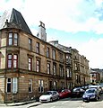
 Battlefield Road (geograph 3438213).jpg 640 × 396; 95 KB
-
 Battlefield Road - geograph.org.uk - 3438144.jpg 480 × 640; 136 KB
-
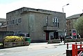
 Battlefield School - geograph.org.uk - 1190030.jpg 640 × 480; 73 KB
-
 Braemar Street (geograph 3438101).jpg 640 × 436; 131 KB
-
 Carmichael Place (geograph 3438095).jpg 640 × 480; 142 KB
-
 Carmichael Place (geograph 3438096).jpg 640 × 469; 145 KB
-

-

-
 Cartside Street, G42 - geograph.org.uk - 2139507.jpg 640 × 480; 88 KB
-
 Cartvale Road, G42 - geograph.org.uk - 2138496.jpg 640 × 480; 94 KB
-
 Cathcart Road at Holmlea Road (geograph 4604314).jpg 800 × 600; 120 KB
-
 Flats on Cartside Street (geograph 6995051).jpg 1,024 × 807; 208 KB
-
 Glasgow tenements - geograph.org.uk - 1138275.jpg 640 × 480; 131 KB
-
 Glasgow wards 2017 no07 Langside.png 2,000 × 2,040; 504 KB
-
 Grange Road at Battlefield Road - geograph.org.uk - 1138286.jpg 640 × 480; 124 KB
-
 Hampden Park Glasgow - panoramio.jpg 3,072 × 2,304; 4.72 MB
-
 Holmlea Road - geograph.org.uk - 2141525.jpg 640 × 480; 160 KB
-
 Holmlea Road - geograph.org.uk - 2141535.jpg 640 × 431; 102 KB
-
 Junction by Battlefield Rest (geograph 7647825).jpg 4,864 × 3,648; 3.3 MB
-
 Langside Avenue (geograph 5305362).jpg 1,600 × 1,042; 330 KB
-
 Langside Court and Battlefield Court (geograph 3437335).jpg 480 × 640; 143 KB
-
 Map of Renfrewshire Sheet 013, Ordnance Survey, 1863-1864.jpg 10,737 × 7,188; 7.87 MB
-
 Map of Renfrewshire Sheet 013, Ordnance Survey, 1863-1864.tiff 10,737 × 7,188; 220.81 MB
-
 Millbrae Road (geograph 3438092).jpg 640 × 427; 132 KB
-
 Overdale Street (geograph 3438093).jpg 640 × 480; 139 KB
-
 Overdale Street - geograph.org.uk - 3438104.jpg 612 × 640; 161 KB
-
 Park at Orchy Street (geograph 2141514).jpg 640 × 424; 134 KB
-

-
 Rannoch Street - geograph.org.uk - 2141470.jpg 640 × 421; 130 KB
-
 Shops on Sinclair Drive, Battlefield, Glasgow (geograph 6971461).jpg 800 × 600; 110 KB
-
 Sinclair Drive - Cartvale Road, G42 - geograph.org.uk - 2138477.jpg 640 × 480; 72 KB
-
 Sinclair Drive - geograph.org.uk - 3438102.jpg 640 × 480; 147 KB
-
 Sinclair Drive - geograph.org.uk - 3438103.jpg 640 × 455; 136 KB
-
 Sinclair Drive - geograph.org.uk - 3438113.jpg 577 × 640; 144 KB
-
 Sinclair Drive, G42 - geograph.org.uk - 2138491.jpg 480 × 640; 77 KB
-
 Tesco Express on Millbrae Road (geograph 3437582).jpg 640 × 433; 116 KB
-
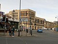
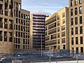 Victoria Infirmary redevelopment (geograph 7645066).jpg 4,032 × 3,024; 3.02 MB
-
 Victoria Infirmary redevelopment (geograph 7647812).jpg 3,648 × 4,864; 4.26 MB
.jpg)


.jpg)
.jpg)
.jpg)
_-_geograph.org.uk_-_2139504.jpg)


.jpg)
.jpg)


.jpg)
.jpg)
.jpg)

.jpg)
.jpg)

.jpg)


.jpg)


.jpg)
.jpg)
.jpg)